Image ChatGPT Image 2
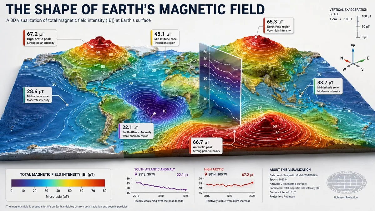
Earth's magnetic field reshapes into a dramatic 3D terrain landscape
A hyper-realistic 3D infographic transforms Earth's magnetic field into a physical terrain, with glowing contour lines and a translucent slice plane revealing internal isolines.
Prompt
[SUBJECT]= [earth's magnetic field] a hyper-realistic 3d infographic displaying [subject] as a physical terrain. layout structure (critical) a 3d landscape rises from a flat base plane, where height and color encode the measured property. contour lines glow at regular intervals along the slopes. a translucent slice plane cuts through one section, revealing internal isolines or a vertical profile. no frames; detail is explored through terrain features and the cutaway. detailing floating 3d markers pin to peaks, valleys, and key isolines: marker label: value + 3–5 word interpretation tiny compass or axis indicator optional: mini sparkline showing temporal change at that coordinate contextual halo a legend translating color gradient to quantitative scale. reference scale of vertical exaggeration. title “the shape of [subject]” style ultra-realistic 3d model, aerial macro photography feel, dramatic raking light to highlight topography, clean infographic overlays.
Published: May 29, 2026 by Gadgetify