Image Nano Banana Pro
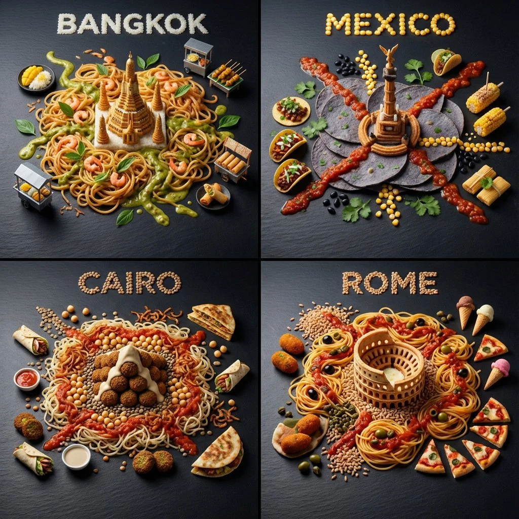
Gastronomic Subway Maps: A Culinary Journey Across Continents
Explore a 3D subway map crafted from street food, showcasing iconic cities with edible landmarks and unique local flavors in vibrant detail.
Prompt
<instructions> Generate one 1:1 image: a 2x2 grid of four different world cities visualized as a 3D subway map made entirely of local street food. Hard randomization: pick 4 famous cities from 4 different continents (no repeats; avoid default set Tokyo/Paris/NYC/LA unless forced).

Each panel: - The 3D city transit map is built from noodles, sauces, herbs, pickles and region appropriate ingredients (colored “lines”), with edible station dots (peas/capers/peppercorns region appropriate ingredients that fit).

 1 iconic landmark “transfer station” built from one dominant local ingredient (e.g., a tower/temple/bridge).

6–10 micro street-food items as “neighborhoods” arranged like mini stalls (tiny skewers, dumplings, tacos, etc.).

City name spelled with edible grains/seeds only (max 8 characters; clean, readable).

Consistency across all panels: dark slate board, true overhead macro, dramatic museum spotlight + soft fill, crisp textures, shallow DOF but readable. No printed text, no logos, no hands, no messy letters, no melted chaos. </instructions>
Published: December 29, 2025 by @Gdgtify