Image Nano Banana Pro
Origami Paris: A Geometric Transformation of the City
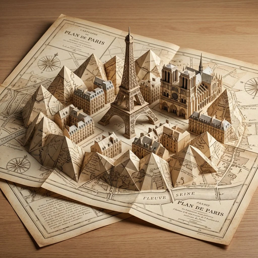
A vintage cartography map folds into a 3D Paris skyline, where sharp, crisp creases define the architecture. The result is a striking, low-poly, geometric vision of Paris in an origami style.
Prompt
do this for Paris: Initialize Rigid Origami Tessellation Protocol:
Sheet = "Single large sheet of vintage cartography paper, laid on a desk"
Crease_Pattern = "Complex Mountain and Valley fold vertices"

//semantic tessellation sequence
Algorithm: Map [CITY_NAME] to Fold_Vertices.
Execute Fold:
As the sheet compresses, the 2D map physically buckles and folds upward into a rigid, 3D geometric skyline of [CITY_NAME].
Constraint 1: No cuts. No glue. The entire 3D city is formed by sharp, crisp origami creases (Mountain and Valley folds).
Constraint 2: AI_INFER(The architecture of [CITY_NAME] is stylized into sharp, faceted, low-poly geometric shapes dictated by the fold lines).
Constraint 3: The un-folded edges of the paper lay flat on the desk, featuring vintage map illustrations.

Style: Photorealistic macro studio photography. Crisp, razor-sharp paper creases.
Published: April 19, 2026 by Gadgetify